Winter storm watch for Central Texas signals possible ice, sleet and dangerous travel around Austin
Winter weather threat expands across Central Texas
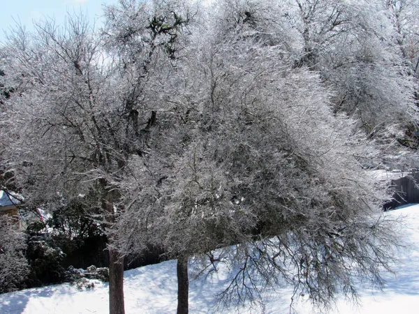
A winter storm watch has been issued for parts of Central Texas, including areas near Austin, as forecast models show a growing risk of freezing temperatures coinciding with rounds of precipitation later this week and into the weekend. The primary hazards under the watch scenario are ice accumulation from freezing rain, along with sleet and localized snow, conditions that can rapidly turn roads hazardous—especially on bridges, overpasses and elevated ramps.
Meteorologists are tracking an arctic air mass expected to push south through Texas while moisture streams in from the Gulf. That interaction increases the likelihood of wintry precipitation, but the precise rain-to-ice transition line can shift significantly with small temperature changes near the surface.
What the setup means for Austin and the I-35 corridor
For the Austin region and much of the I-35 corridor, the forecast concern centers on freezing rain and sleet rather than heavy snowfall. Recent probability guidance for portions of the Hill Country and areas along and north of I-35 has indicated a higher likelihood of at least a light glaze of ice, while confidence remains lower on exact totals and timing at the city-to-city level.
The watch stage reflects elevated potential for impactful winter weather, but not yet the higher confidence typically associated with warnings. Forecasters have cautioned that the most significant travel impacts, if icing develops, could occur overnight and during early-morning periods when road temperatures are lowest.
How watches can change, and what to monitor
A winter storm watch is commonly followed by upgrades—such as a winter storm warning—when confidence increases that significant accumulation and impacts are likely. It can also be adjusted geographically as the expected corridor of freezing temperatures and precipitation becomes clearer.
Timing: The window of greatest concern generally aligns with the arrival of subfreezing air and the heaviest precipitation bands.
Type of precipitation: Central Texas events often hinge on whether precipitation falls as cold rain versus freezing rain or sleet.
Impacts: Even modest ice can create widespread driving hazards and raise the risk of isolated power disruptions if icing becomes more extensive.
Preparedness actions underway and safety guidance
Local agencies in the Austin area have previously responded to winter events by pre-treating critical roadways and discouraging travel when icing is occurring. Officials typically stress layered clothing for warmth, safe use of space heaters, and avoiding indoor use of grills or ovens due to carbon monoxide risk. Residents are also urged to plan for potential travel disruptions and to protect pipes, pets and plants ahead of extended cold.
Forecast confidence is high that colder air will arrive, but lower on the exact corridor and duration of freezing precipitation—details that will determine whether the watch expands or upgrades.